GIS Analysis on Urban Migration Patterns in Berlin 2005-2010
Cornell University
Fall 2011
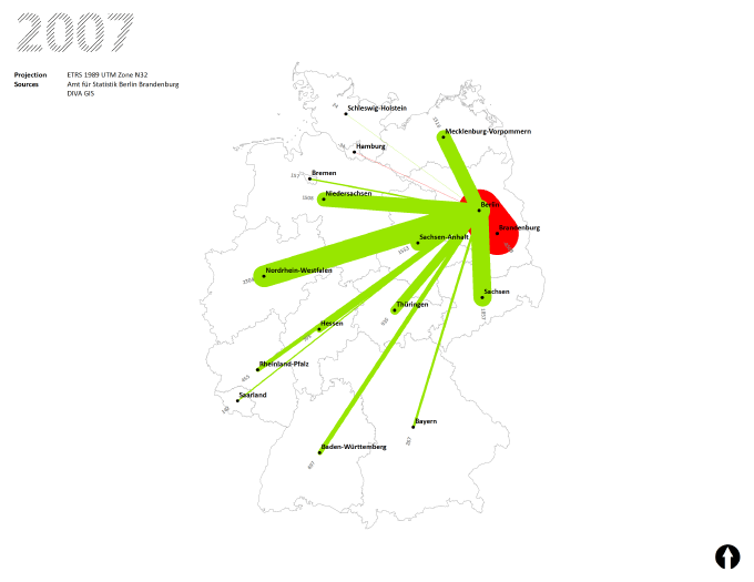
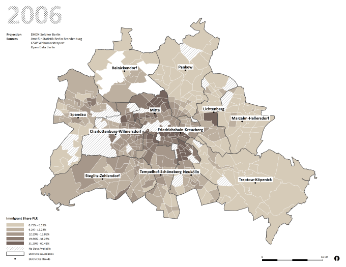
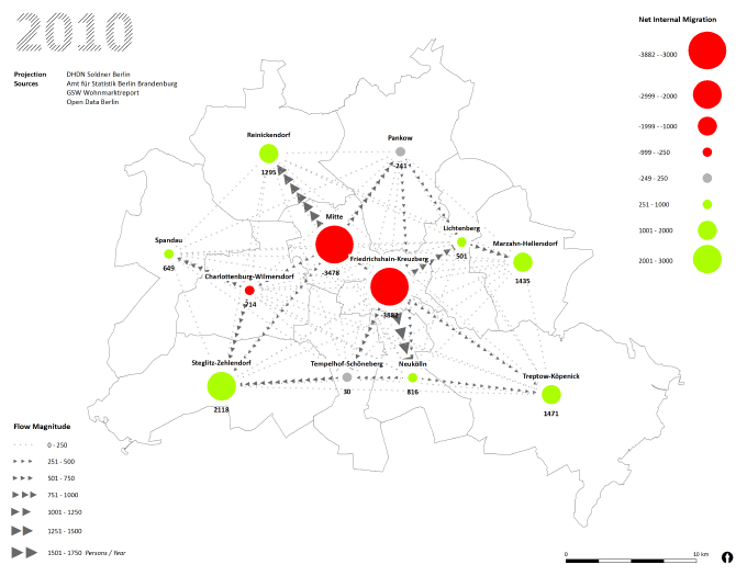
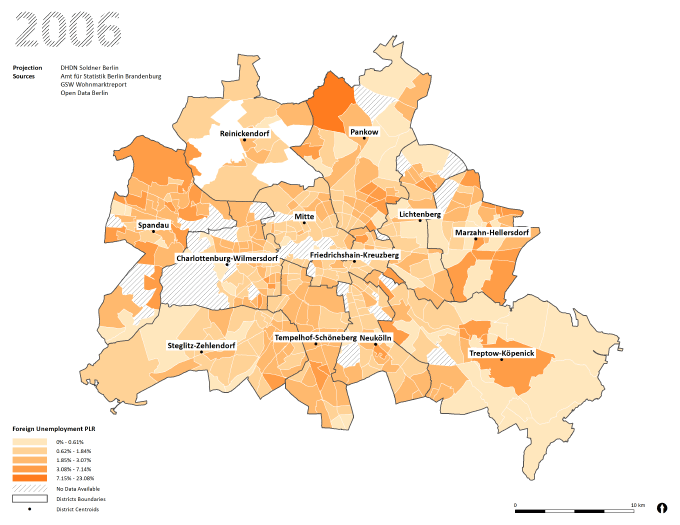
I used Berlin’s new Open Data initiative to create a series of GIS-generated maps, displaying socio-spatial developments between 2005 and 2010.
 Copyright 2024